Kannur : The land of Looms and Lores
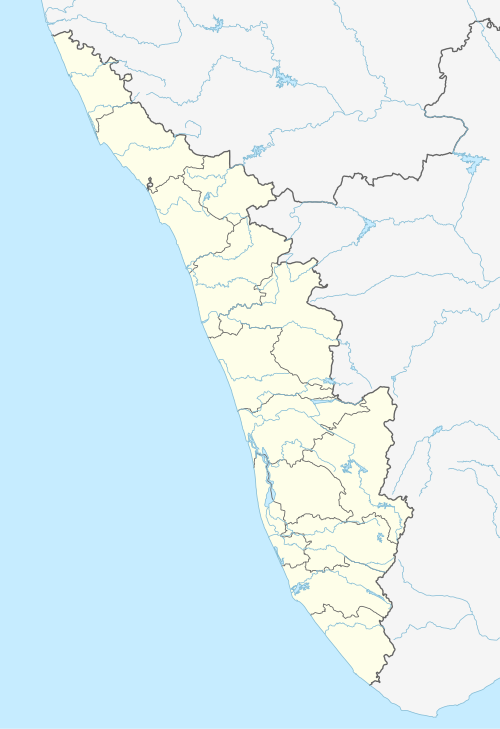
Kannur, also known by its anglicised name Cannanore,[1] is a city and a Municipal Corporation in Kannur district, state of Kerala,India. It is the administrative headquarters of the Kannur District and situated 518 km north of the state capital Thiruvananthapuram. During British rule in India, Kannur was known as Cannanore, a name that is still in use by the Indian Railways.[2] Kannur is the largest city of North Malabar region. Kannur is one of the million-plus urban agglomerations in India with a population of 1,642,892 in 2011.
Kannur district is known as the land of Looms and Lores, because of the weaving industry functioning in the district and ritualistic folk arts held in temples. Kannur is famous for its pristine beaches, Theyyam (its native performing art), and its handloom industry.
Kannur is of great strategic military importance in India. Kannur Cantonment is one of the 62 military cantonments in the country and is the headquarters of theDefence Security Corps and Territorial Army’s 122 Infantry Battalion (part of the Madras Regiment). The Indian Naval Academy (INA) is 35 km north of Kannur City. It is Asia's largest and the world's third largest naval academy. An Indian Coast Guard Academy has received approval to be built at Kannur. This academy will be built on the banks ofValapattanam River at Irinave, east ofAzhikkal.
Etymology
The name Kannur.[3] may have been derived from Kanathur, an ancient village. There are many myths and legends associated with the name Kannur. It is believed to be a portmanteau derived from two Malayalam words, ‘Kannan’ (Krishna, a Hindu deity), and ‘Uuru’ (place), the Land of Lord Krishna. During the British Raj, the city was known by its anglicised name Cannanore, the Portuguese version of its ancient name, 'Kannanore'.
History
Kannur was an important trading center in the 12th century, with active business connections with Persia and Arabia. It served as the British military headquarters on India's west coast until 1887. In conjunction with its sister city, Tellicherry, it was the third largest city on the western coast of British India in the 18th century after Bombay and Karachi.
Kannur is a very ancient city which used to be one of the three important cities of the whole western Indian sub continent 200 years ago; competing with Bombay and Karachi. It is said to be that the Loud Sage – the ship of King Solomon had anchored off the coast of Kannur to gather wood for the construction of the Temple of the Lord. Kannur's name has mentions in the Periplus of the Eritrean Naura and sea, a work of the great Greek antiquity.
The original city of Kannur was under Kerala's only Muslim Royal dynasty called the Arakkal Sultanate and it was their capital. This area is still known as Kannur City. The modern town is referred as Kannur Town. Kannur, as a district and surrounding areas were mostly ruled by the famous Kolathiri rajas (kings). When the state of Kerala was formed the district took the name Kannur, since the administrative offices were established here. Before that, Kannur was under the Chirakkal Taluk of Madras state under British rule. When the British dominated this part of the world, they preferred Madras and Cochin as their major stations and Kannur started to lose its old glory. The people of Kannur are still waiting for their old glory to get back and they feel they are being sidelined because the state administration is located exactly opposite side of the state.
Kannur was known to the Chinese, Greeks, Romans, Persians, Hebrews and Arabs thousands of years back and it was used to be the trading hub for mainly spices, timbers, etc. It was the only place in entire India (!!!) which was targeted by Portuguese, Dutch, French, British and Germans and used for trading by Arabs, Hebrews, Persians, etc. for reasons unknown and no clear history to go back and verify. The border town of Kannur district named Mahe is still called French Mahe, because it was ruled by French and is under Pondicherry not under Kerala Government. The Portuguese built their first fort in Kannur, possibly because Kannur was their main target in India. Since Kannur was the biggest town in the western Indian Sub Continent, up to 200 years back, the city must have been well known outside India and become a target for the European traders. Kannur and its twin sister town Thalassery are well known for their distinct food dishes, which display an elegant combination of food styles from the native territory, as well as from the territories that traded with them.
St. Angelo Fort was built in 1505 by DomFrancisco de Almeida, the first Portuguese Viceroy of India. The Dutch captured the fort from the Portuguese in 1663. They modernised the fort and built the bastions Hollandia, Zeelandia and Frieslandia that are the major features of the present structure. The original Portuguese fort was pulled down later. A painting of this fort and the fishing ferry behind it can be seen in the Rijksmuseum Amsterdam. The Dutch sold the fort to king Ali Raja of Arakkal in 1772. During the 17th century, Kannur was the capital city of the only Muslim Sultanate in Kerala, known as Arakkal.[4] Then the Britishconquered it in 1790 and used it as one of their major military stations on the Malabar Coast. During the British Raj, Kannur was part of the Madras province in the North MalabarDistrict.
The guerrilla war by Pazhassi Raja, the ruler of Kottayam province, against the British had a huge impact in the history of Kannur. Changes in the socio-economic and political sectors in Kerala during the initial decades of 20th century created conditions congenial for the growth of the Communist Party. Extension of English education initiated by Christian missionaries in 1906 and later carried forward by government, rebellion for wearing a cloth to cover upper parts of body, installing an idol at Aruvippuram in 1888, Malayali Memorial in 1891, establishment of SNDP Yogam in 1903, activities, struggles etc. became factors helpful to accelerate changes in Kerala society during a short time. Movements for liberation from the colonial rule of British imperialism and struggles launched by these movements grew with them.
Very soon, ideas about socialism and Soviet Revolution reached Kerala. Such ideas got propagated in Kerala through the works ofSwadeshabhimani Ramakrishna Pillai,Sahodaran Ayyappan, P. Kesavadev and others.By the beginning of the 1930s some other useful developments were taking place. Important among them was Nivarthana Agitation in Travancore. That was the demand of people suppressed so far as untouchables and weaker sections for participation in government. This brought to the forefront struggles like proportional representation in government and reservation of jobs. This imparted a new enthusiasm among oppressed masses.[5]


No comments